
Ski, hike and connect to the Ktunaxa Rockies
Posted

Visit the #Ktunaxahomelands to learn how each lake, river, and waterfall belong to each other - their origins traced back to ancestral times - as you adventure here.
Pulsing through the Kootenays, the waterways of Ktunaxa shape the landscape, the culture, and the spirit of all who swim, play, fish, paddle or simply go with the flow here. To many visitors, these waterways bring fun, recreation, relaxation and a sense of adventure.
But to the Ktunaxa people who have traveled in and occupied the area for more than 10,000 years, these waterways also bring survival, strength and nourishment.
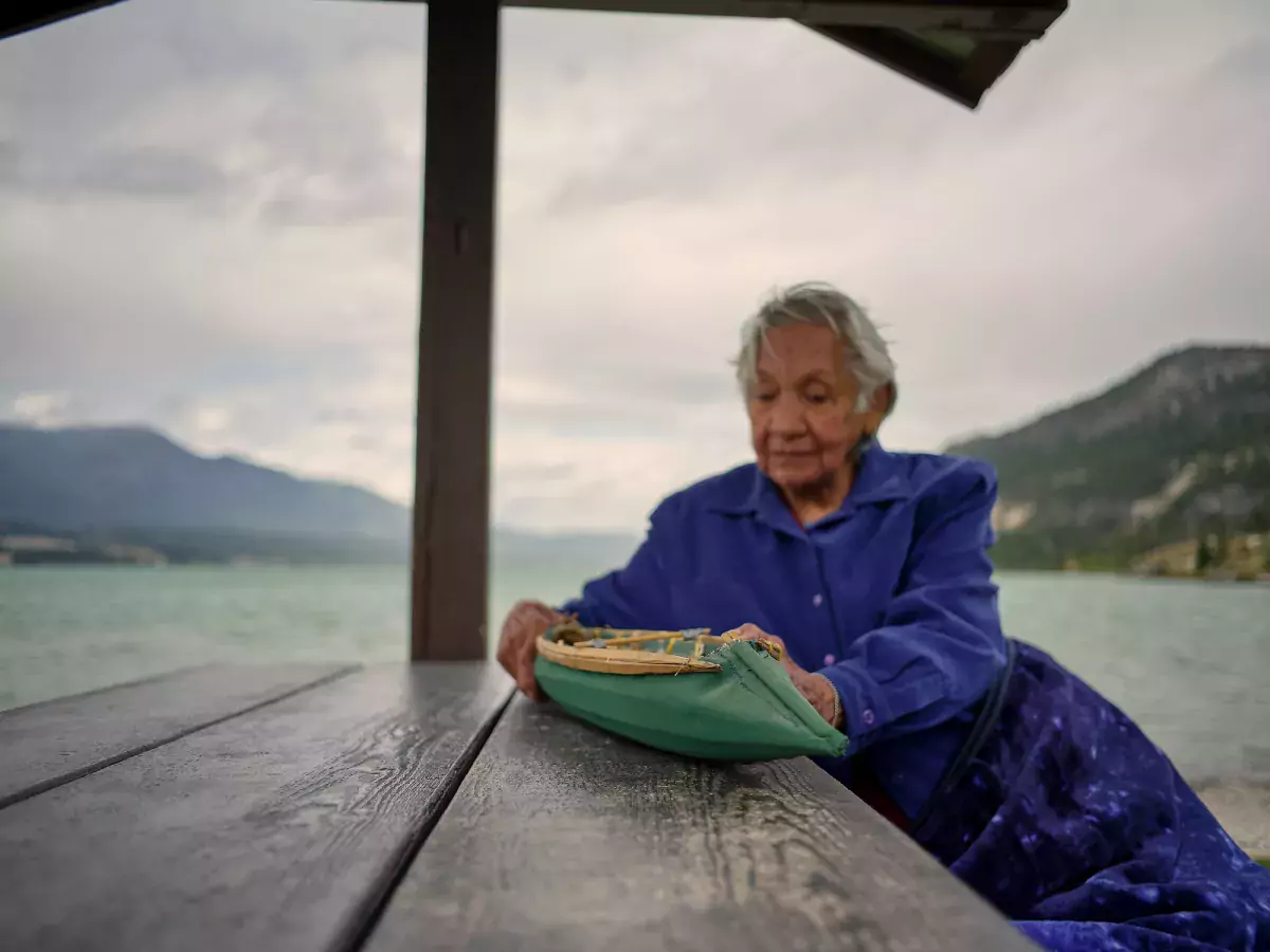
“Water has always played a vital role for Ktunaxa People. From the area’s mineral hot springs to the waterfalls, lakes, rivers and wetlands, they are tied to our Creation,” explains Janice Alpine, tourism engagement lead for the Ktunaxa Nation Council.
“It’s my hope that by communicating our stories, history, ways, traditions and connection to the land we’ll raise awareness, increase understanding, and build new relationships based on mutual values and respect. This is an important aspect in protecting the environment we depend on.”
Since time beyond the reach of memory, the homelands of the Ktunaxa People were ruled by spirit animals. Yawuʔnik̓, a huge water monster, bothered many of the animals. With news of the human race coming to earth, it was decided by the chief spirit animal, Naⱡmuqȼin, that Yawuʔnik̓ must be killed. A Big Chase ensued.
Yawuʔnik̓ swam the Kootenay and Columbia waterways, creating one of the world’s biggest continuous river systems. Eventually, Naⱡmuqȼin and his war party were victorious in his pursuit of Yawuʔnik̓, capturing the water monster and killing him.
The waterways—all lakes and rivers, sloughs and waterfalls—formed during the Big Chase, linking the Ktunaxa People to the waters and providing sustenance.
They fished these waters, travelled them, and used them for hunting, foraging, and ceremony. Ktunaxa relied heavily on boats to navigate the landscape, and created the unique and widely-admired sturgeon-nosed canoe to traverse Rocky Mountain swampy waterways.
As a visitor to this place, you are invited to connect to the #KtunaxaHomelands and the deeper significance to this place, with this water-themed itinerary.
When you visit and adventure on these waters, you are invited to connect to the #KtunaxaHomelands and the deeper significance to this place.
Here is a water-based itinerary that you can do over three days or cherry pick your favourites. For more ideas of what to do and where to explore in Kimberley/Cranbrook, check out their visitor websites at Tourism Kimberley or Cranbrook Tourism.
We encourage you to share what you find using the hashtag #KtunaxaHomelands.
Take an easy, 3km hike (round trip) on The Source of the Columbia Trail to the headwaters of the 2,000 km Columbia River. You’ll wind through wetlands to a viewpoint where you can see the water bubbling out of the ground. Poplars, spruce and willows line the pathway. Just off the trail, watch for wildflowers, insects, birds and wildlife.
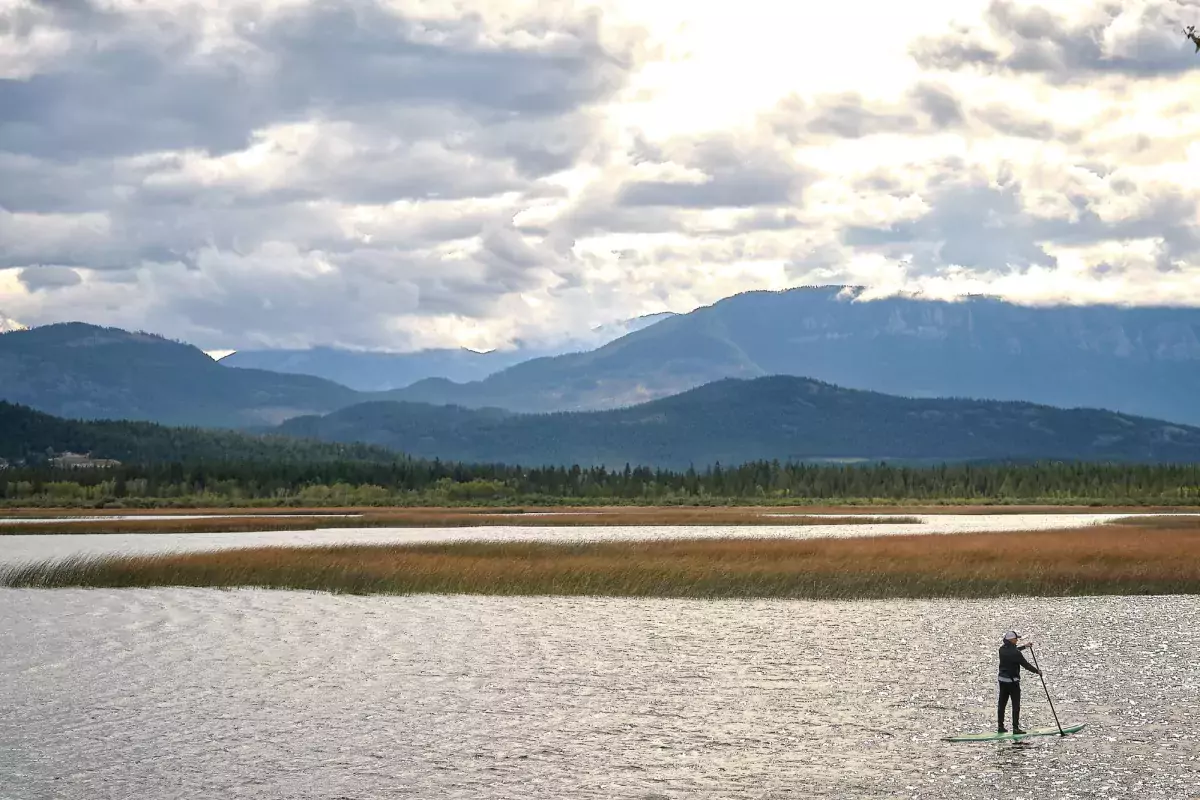
Refresh on the water after your hike on the warm waters of Columbia Lake, accessed from Tilley Memorial Park at the lake’s southeast end. The park has a boat ramp, picnic tables, washrooms, a large beach and swimming area, as well as wheelchair access. It’s also the perfect place to launch a canoe, kayak or paddleboard. The Ktunaxa People hold great reverence for the east side of Columbia Lake as the site of their Creation.
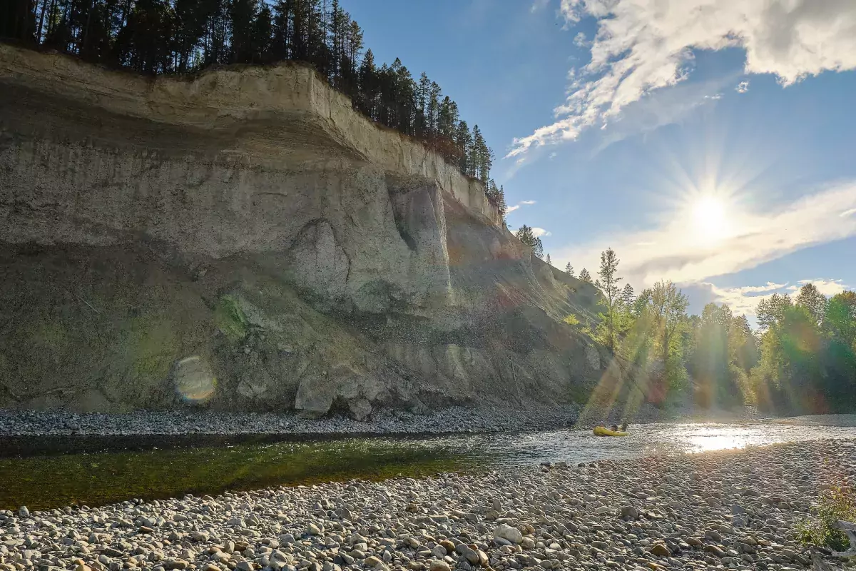
Keen on a paddle? Take a trip down the Kootenay River, popular for kayakers and rafters. Begin at Bummer Flats between Wasa and Fort Steele and paddle down the river to just after the bridge by Fort Steele. This trip takes about two hours and consists of mostly slow moving current.
Like to cast a line now and then? The river is also known for bull trout fishing, as well as rainbow and cutthroat.
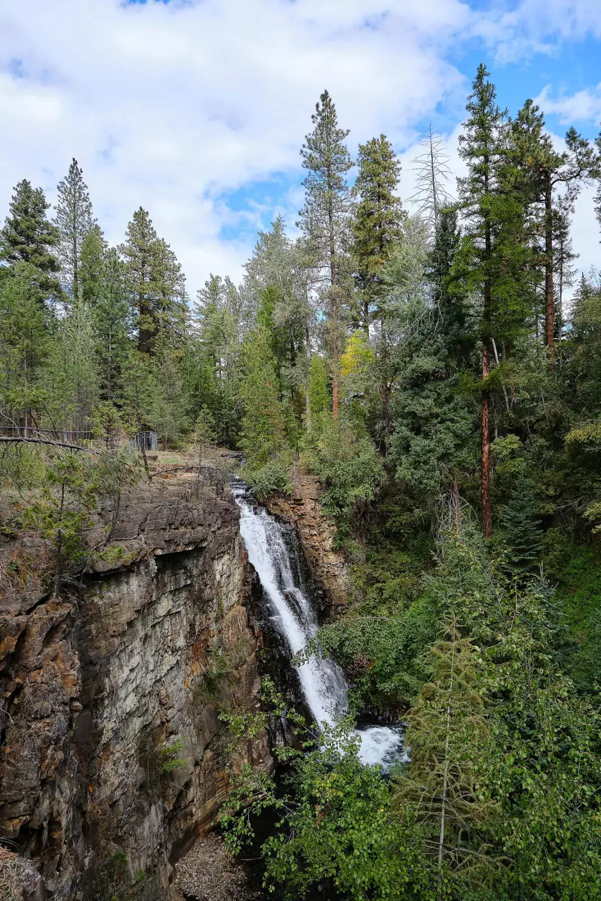
The stunning Marysville Falls is accessed by a short, mostly boardwalk path just south of Kimberley in Marysville. Waterfalls have always held significance for the Ktunaxa People, who view the rushing waters as being pure in form and healing for the spirit. From the trailhead, it is an easy 10 - 15 minute stroll to a viewpoint overlooking the 30-metre waterfall.
Paddle Bummer Flats and watch for wildlife in the gentle marshland waterways. A 25-minute drive from Cranbrook on the Kootenay Highway (BC 93/95), this rich grassland habitat between the highway and Kootenay River is a good place for easy paddling or spotting riparian or grassland species.
There’s no shortage of lakes in the homelands of the Ktunaxa. The popular but secluded Lazy (Rock) Lake is always a good choice for a relaxing paddle. Directions: Travelling North from Cranbrook on Highway 93, turn East on Wasa Lake Park Drive. Continue East on Lazy Lake Road for 14 km. The recreation site will be on the right at the junction of Lazy Lake Rd and Wolf Creek Rd.
For more ideas on how to enjoy local lake life, visit Cranbrook Tourism.
For more ideas of what to do and where to explore in Kimberly/Cranbrook, check out their visitor websites at www.tourismkimberley.com or www.cranbrooktourism.com.
Naⱡmuqȼin, taxas q̓apiⱡhukinʾni qapsins
As Naⱡmuqȼin fulfilled his prophecy the waterways were formed.
More adventures await! Learn more about Ktunaxa creation, connect and adventure further with these stories.
Like Our Facebook Page


